
You might not know that the same beach view that looks perfect for a drone shot on Oahu can sit under controlled airspace, a wildlife buffer, or a park rule that stops you cold. Before you launch into that warm trade wind with Diamond Head in frame and surf thumping below, you need to sort out FAA rules, local limits, and a few no-fly surprises that catch visitors fast.
Key Takeaways
- Drones are legal on Oahu if you follow FAA rules, Hawaii local restrictions, and any site-specific park, beach, or closure rules.
- Register drones weighing 0.55 pounds or more, enable Remote ID if required, and carry your TRUST or Part 107 certificate.
- Keep your drone within visual line of sight, stay at or below 400 feet AGL, and obey any official order to stop flying.
- Check B4UFLY, LAANC, NOTAMs, and TFRs before every flight, especially near Honolulu controlled airspace and Daniel K. Inouye Airport.
- Avoid crowded beaches, state parks, military areas like Pearl Harbor, wildlife refuges, and other protected or temporarily restricted zones.
Are Drones Legal on Oahu?
Yes, drones are legal on Oahu, but you can’t just launch anywhere the trade winds feel inviting. When you fly drones Oahu, you need to follow FAA regulations like keeping your craft in sight and below 400 feet. If it weighs 0.55 pounds or more, register it with the FAA.
The island also has plenty of restricted areas. Waikiki Beach, Pearl Harbor, military sites, and Honolulu airport airspace can shut you down fast. State parks and federal park rules add more limits, so check B4UFLY or Aloft before takeoff. Keep geofencing updated and scan NOTAMs and TFRs. Fines can sting, too. Complete recreational TRUST if you’re flying for fun, and know Part 107 exists for business flights. Some permits come first on Oahu too. Beginning September 16, 2023, any drone that requires registration must also broadcast Remote ID unless you fly within a FRIA.
Which Oahu Drone Rules Apply to You?
The rules that apply to you on Oahu depend first on why you fly, because recreational pilots and commercial operators don’t start in the same lane. You’ll need to match FAA requirements with Hawaii state rules and local beach, park, and neighborhood limits, especially around busy places like Waikiki and airport corridors where the sky gets tight fast. A quick check before takeoff can save you $5, a permit headache, or an awkward walk back from the sand with your drone still in its case. If your flight plan includes state park areas, note that Nuʻuanu Pali is open daily from 6:00am to 6:00pm and charges non-residents $7 per vehicle for parking.
Recreational Vs Commercial
Whether you’re filming Diamond Head for fun or shooting hotel footage for a client, Oahu asks you to sort out one key question first: are you flying recreationally or commercially? If you’re flying for fun, you need the Recreational UAS Safety Test, and you must register any drone that weighs 250 grams or more. You also follow the basic FAA limits: keep your drone in sight and stay at or below 400 feet. Recreational flyers must pass TRUST before flying, and if they lose their completion certificate, they must retake the test. If money or business is involved, you step into FAA Part 107. That means a Remote Pilot Certificate, registration, and Part 107 rules unless you have a waiver. Either way, controlled airspace near Honolulu often needs LAANC authorization, and restrictions in state parks and other sensitive areas still apply to everyone.
Federal, State, Local Rules
On Oahu, your flight plan has to pass three checkpoints: federal FAA rules, Hawaii state rules, and local site bans that can change from one beach or park to the next.
- Keep drones under 55-lb limits, below 400 feet, and in sight.
- Get TRUST for fun flights, or Part 107 for paid work.
- Near HNL, many zones need FAA approval through LAANC.
- Don’t launch in state parks, or over Waikiki Beach, Pearl Harbor, refuges, or bases.
Check B4UFLY or Aloft before takeoff. Oahu’s map shifts with NOTAMs, TFRs, and geofenced pockets. Register any drone at or above 0.55 pound with the FAA. Break a rule, and your sunset session can end with fines instead of ocean breezes and the surf’s steady hush nearby today. On Oahu, note that state park closures can affect access, including Mauna Ala, Royal Mausoleum State Monument being closed February 6, 2026 for palm maintenance.
What Flight Rules Must Oahu Pilots Follow?
Before you send a drone over Oahu’s bright reefs and ridgelines, make sure you’re flying by FAA rules. Keep VLOS, stay under 400 feet, and check NOTAMs with B4UFLY or Aloft before takeoff. If you fly for fun, pass TRUST and register drones 0.55 pounds or more. If you work, you’ll need FAA Part 107. Near airports, controlled airspace needs authorization, and if officials tell you to stop, you stop. Respect rules protecting crowds, wildlife, and state parks too. Military geofences can surprise you, so never assume map stayed green. For fast-changing conditions, monitor NWS Honolulu updates and local weather radio before takeoff.
| Rule | What you do | Why it matters |
|---|---|---|
| VLOS | Keep eyes on it | Ocean light tricks you |
| 400 feet | Stay low | Hills rise fast |
| TRUST/107 | Carry proof | Rangers may ask |
| Airspace | Get approval | Jets sound close |
Where Can’t You Fly a Drone on Oahu?
Although Oahu looks like a drone dream from almost every overlook, some of its most tempting places are off-limits. You can’t launch in state parks, including Hanauma Bay, and you shouldn’t buzz crowded sands like Waikiki Beach. Stay clear of controlled airspace around Daniel K. Inouye International Airport, plus heliports, unless cleared. National Park rules matter too. On Oahu, protected historic areas can block flights, and Hawaii Volcanoes National Park is off-island anyway. Add military installations, wildlife refuges, and emergency zones, and your no-fly map gets serious fast. In coastal hazard areas, remember that evacuation zones mark only the minimum safe distance during tsunami planning and response.
- Hanauma Bay and many popular scenic coastal state parks
- Waikiki Beach and all other packed public shores nearby
- Pearl Harbor, Schofield Barracks, and other active military installations
- Airport zones, wildlife refuges, and strict temporary flight restrictions
Do You Need a Permit to Fly on Oahu?
Here’s the good news: you don’t need a special island-wide permit to fly a drone recreationally on Oahu. That said, you still need to follow federal basics. If your drone weighs 0.55 pounds or more, FAA registration is required, and it costs $5. You should also pass the TRUST test before takeoff.
If you’re flying for work, photos, or paid content, you’ll need FAA Part 107 instead of a simple permit. You may also need airspace authorization when your route touches controlled airspace. Keep your drone below 400 feet and within sight, and check B4UFLY or LAANC before each launch. On Oahu, the breeze can feel easygoing, but the rules aren’t guessing games. A quick preflight check saves hassle, money, and that sinking stomach feeling. If you’re planning a shoreline launch, NOAA’s Tide Predictions can help you time beach access, though the tool notes a maximum range of 31 days.
Where Can You Fly a Drone on Oahu?
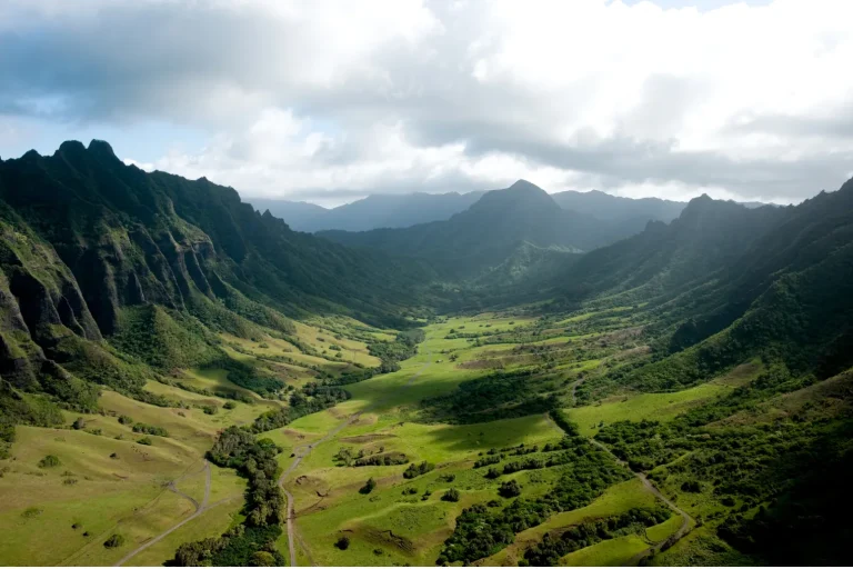
On Oahu, you can fly your drone in some open and remote areas if you follow FAA rules, stay under 400 feet, keep it in sight, and avoid controlled airspace unless you’ve got authorization. You can’t launch in Hawaii state parks, near Pearl Harbor or other military sites, or around Honolulu’s airport zones without clearance, and Waikiki’s crowded beaches are usually more trouble than they’re worth. Before you head out, check B4UFLY or Aloft and scan for NOTAMs or TFRs so you can find a legal spot where the trade winds and views feel worth the effort. If you visit Makapuʻu Point, remember the trail sits within Kaiwi State Scenic Shoreline, where conditions are often sunny, hot, and windy, so plan carefully and stay on the trail.
Allowed Flying Areas
Open-sky spots do exist on Oahu, but they’re usually in quieter, less developed areas where you can stay below 400 feet AGL, keep your drone in visual line of sight, and follow FAA rules for either recreational or Part 107 flying. Think inland clearings, rural edges, and open coastlines outside state parks, where surf noise and trade winds remind you to fly carefully. Before launch, check LAANC or B4UFLY, since much of Oahu sits near controlled airspace. Oahu’s weather by area can shift quickly around the island, so a legal launch spot on one side may have very different wind and visibility conditions than another.
- Stay low and keep visual contact
- Bring TRUST or your FAA Part 107 certificate
- Skip crowded beaches and urban cores
- Recheck wind, weather, and app alerts
You’ll find the best legal flights where people are few, sightlines are wide, and maps show no-fly zones well away that same day.
No-Fly Zones
Because Oahu packs airports, military bases, busy beaches, and protected parkland into one island, your no-fly map matters as much as your battery level.
Check these hotspots:
| Zone | Why |
|---|---|
| Daniel K. Inouye Airport | Need ATC or LAANC within five miles |
| Waikiki Beach | Crowds and local safety restrictions |
| Pearl Harbor | Military no-fly zones bring severe penalties |
| state parks | No launching or landing on park land |
If your route includes the island’s southeast shore, areas around Makapuu Lookout may overlap with scenic tour corridors and require extra caution before takeoff. Near Diamond Head, many beach and park areas are also off-limits. Use B4UFLY or Aloft before every flight to catch TFRs, geofenced zones, and surprise closures. On Oahu, a quick map check saves hassle, fines, and that sinking feeling when your perfect sunrise spot turns out grounded. If waves are hissing and helicopters are buzzing overhead, pause and verify boundaries first.
How Do You Check Oahu Airspace Before Flying?
How do you know Oahu’s sky is actually open for your drone and not just beautifully blue? You check before sandals hit the sand. Start with B4UFLY or LAANC to see controlled airspace, TFRs, and NOTAMs. If you’re near Daniel K. Inouye International Airport, stay five miles out or get airspace authorization. Then match FAA info with Oahu drone maps and Hawaii DLNR rules, because a quiet beach or temple overlook may still ban flights. You can also monitor the U.S. Tsunami Warning Centers for a Tsunami Information Statement that confirms there is no tsunami warning, advisory, watch, or threat in effect.
- Check B4UFLY and LAANC for live airspace status
- Review NOTAMs and FAA UAS Facility Maps before launch
- Watch Pearl Harbor and Hickam areas for restrictions
- Update geofencing and firmware, then recheck right before takeoff
Oahu’s airspace can change fast. A surprise TFR can appear quicker than a rain squall over the Koʻolau Range.
Frequently Asked Questions
What Are the Penalties for Breaking Drone Laws on Oahu?
You can face criminal fines, civil liability, license revocation, and equipment seizure, plus jail sentences for breaking drone laws, with FAA penalties reaching $27,500 recreationally or $250,000 commercially for reckless, restricted, or repeat violations.
Do Tourists Need Any Special Documents to Fly Drones on Oahu?
Yes, you’ll need FAA registration for qualifying drones, TRUST proof, and possibly Part 107. You won’t need a passport photocopy, temporary permit, travel insurance, or local waiver unless a site, business, or authority requires them.
Can You Fly a Drone Over Private Property on Oahu?
Yes, you can fly over private property on Oahu there if you follow FAA airspace permissions, keep visual line, respect overflight etiquette, seek neighbor consent, and avoid trespassing, privacy violations, and conflicts with property easements.
Is Drone Insurance Required or Recommended on Oahu?
No, you aren’t legally required to carry drone insurance on Oahu for recreation, but you should get liability coverage; weather risks, equipment warranties, commercial exceptions, and insurance costs make coverage a smart choice for you.
Are There Privacy Laws Affecting Drone Photography on Oahu?
Yes, you can’t let your camera wander where curtains should suffice; Oahu’s privacy statutes and surveillance restrictions affect photography. You must respect image consent, data retention, and neighborhood expectations, or you’ll risk complaints and liability.
Conclusion
On Oahu, you can fly legally if you do the homework first. Check airspace, update your gear, and keep clear of parks, beaches, wildlife zones, and military areas. Think of the island like a patchwork quilt. Some squares welcome you, some definitely don’t. When you hear surf, feel trade winds, and see ridgelines glowing at sunset, good planning matters. Follow the rules, stay alert, and your drone day can feel smooth, safe, and spectacular.